Website Supporters:
Nautical books from:
|
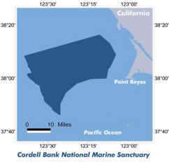
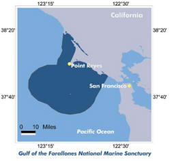
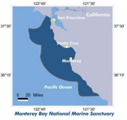
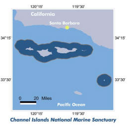
California Marine Sanctuaries
|
|
PLEASE VISIT OUR SUPPORTERS |
|
|
|
|
 |
|
|
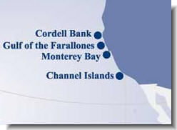
California Marine Sanctuaries
Locations
|
| |
 |
In 1972, exactly one
hundred years after the first national park was created, the nation
made a similar commitment to preserving its marine treasures by
establishing the National Marine Sanctuary Program. Since then,
thirteen national marine sanctuaries, representing a wide variety of
ocean environments, have been designated.
Today, our marine sanctuaries encompass deep ocean gardens, nearshore
coral reefs, whale migration corridors, deep sea canyons, and even
underwater archeological sites. They range in size from one-quarter
square mile in Fagatele Bay, American Samoa to over
5,300 square miles in Monterey Bay, California, one
of the largest marine protected areas in the
|
|
world. Together these sanctuaries protect nearly 18,000 square
miles of ocean waters and habitats, an area nearly the size of Vermont
and New Hampshire combined. While some activities are regulated or
prohibited in sanctuaries to protect resources, multiple uses such as
recreation, commercial fishing, and shipping, are encouraged.
Research, educational, and outreach activities are other major
components in each sanctuary's program of resource protection.
Use links below for further information on use of resources and to
the restrictions governing these areas.
Check
here for further National Marine
Sanctuaries Program information.
|
California Marine Sanctuaries
|
|